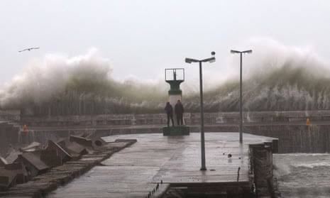
The Western Cape has been hit by a series of severe storms and floods that have caused widespread damage and disruption across the province. The South African Weather Service (SAWS) issued several warnings for disruptive rain, thunderstorms, strong winds and rough seas in the past week, as cold fronts and low-pressure systems brought heavy rainfall to the region.
According to the Western Cape Local Government and Environmental Affairs MEC Anton Bredell, the disaster management centre has been activated across the province to respond to the flooding and weather-related incidents. He said that teams were busy with rescue operations, road closures, power outages and relief efforts in various areas.
Some of the worst affected areas include:
- The Overberg Region, where up to 170mm of rain was recorded in the last 24 hours. Hermanus, Stanford, Gansbaai, Struisbaai and Grabouw experienced severe flooding that trapped people in their homes and vehicles. The NSRI rescued 11 people in Stanford and seven families in Grabouw, as well as three people whose boat overturned.
- The City of Cape Town, where low-lying areas such as Philippi, Strand, Gugulethu, Mfuleni, Masiphumelele and Khayelitsha were inundated by floodwaters. The Lourens River burst its banks and flooded an Eskom substation that left parts of the Helderberg area without electricity for a long time. A farm dam collapsed in Joostenberg Vlakte and flooded surrounding properties. The Melomed Hospital in Tokai also flooded after the Keyser River overflowed for the second time.
- The Cape Winelands, where the Berg River was full and threatened to overflow in Paarl. Stellenbosch received about 133mm of rain in the last 12 to 24 hours. The Franschhoek Pass was closed due to rockfalls.
Bredell said that their biggest concern was road safety, as many people were returning from the long weekend. He urged motorists to abide by the calls of the traffic officials and police, and to avoid driving through flooded roads. He said that some of the major roads that were closed included the N2 in Botriver, Sir Lowry’s Pass, Rooi Els Pass and Villiersdorp.
The SAWS said that more rain was expected in the southern parts of the Western and Eastern Cape on Monday, as a cut-off low-pressure system moved to the southern coast. These areas could experience between 60-100mm of rain in 24 hours and gale-force winds. The cold front was expected to move away from the country on Tuesday.
The SAWS advised residents to stay indoors if possible, monitor weather reports, prepare for possible power outages, move valuables to higher ground, avoid crossing rivers and swollen streams, and contact emergency services if in need of assistance.


GIPHY App Key not set. Please check settings